Hello from what was Grandfather Mountain. Well, it still is Grandfather Mountain, of course, but, unfortunately, I'm no longer there. I left Spartanburg around 8am on Saturday (full day off #4--see, I told you I go to the mountains on my day off) and drove some back highways--rather disappointing in their lack of mountain views at times--to just outside Linville, North Carolina. I can't remember how I found Grandfather Mountain on the map, but I decided on visiting pretty instantly. A Mile High Swinging Bridge--who can reject that?

I first stopped at the Visitor's Center about halfway up the mountain and ate an expensive lunch of pork bbq sandwich, fries (really good!), coleslaw (really dry), and coke before checking out the habitat areas. The animals in the habitats--black bears, deer, cougars, otters, and eagles--are all wild on the mountain but were in large enclosures here. It was about time for "bear enrichment" when I arrived, so the bears were very interested in the onlookers.

The one above, Carolina, stood. The worker who threw them frozen peanut butter balls said that the one with her tongue out used to have a mouth problem and would stick her tongue out to relieve the pain. Well, of course they fed her when she did that, so now it's her little trick. They want her to lose it, though. These bears shouldn't have tricks.

The clouds hung over us, moving quickly but lingering.

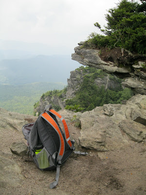
And then, after buying some chocolate peanut butter fudge from the fudge shop, I drove up to the lower parking area for the Swinging Bridge so that I could hike the rest of the way. It was a rocky but fairly moderate .4 mi. hike. I had my backpack, all decked out.

I first passed under the bridge and touched the springs and cables that held it.

And then I crossed it, and it giggled and swing slightly. It swing slightly from the weight of the people walking across it both ways, and slightly from the boys who gripped the sides and tried to make it move. Their mothers usually squealed. On the other side, I made my way over rocks, all natural and unpaved, without steps, to the ledge, the outermost ledge where I could be on the edge, near nothing, above everything, and sit. The picture below is the view of the outcrop just beyond my feet, and beyond, that I couldn't get to. And what follows are the views from my seat, alone, except for the man who briefly sat behind me and worried about getting vertigo. I told him I only kind of felt like I was floating, like I wasn't sure if there was anything below me, but that it was worth it. I was not scared--only felt that feeling of doubt of ground.


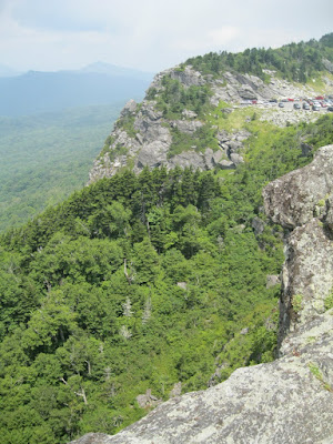
Then the next picture looks back at the bridge, where I started on the other side. This looks back at the upper parking lot (where I hiked up to) and, beyond, Macrae Peak, blurry in a cloud.


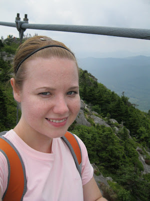
See the cable? I'm on the bridge, walking back across to the start of the crest trails.

I just set out, by myself, with my pack and eagerness and determination, to go as far as I could in the time I had and with the bravery and skills I had.
It was wonderful, strenuous, rocky, with cables and slick rocks and high steps and roots to grab and clouds and overlooks. (Unfortunately, you always catch me in moments of exhaustion, when I don't have a chance to truly elaborate here. Trust me, it was work and worth it.) The first ladder came, and I stood in shock for a moment. This photo is no trick of the eye; the angle is accurate. I shimmied between boulders and climbed out, up.

And up. And kept going. With only two moments of hesitation. One, which you'll see later, at a point where the climbing got vertical and where, at the very bottom of it, I slipped while trying to get my foot up on a rock and scraped my left shin and knee. Blood. I thought that may be a sign to stop, considering I don't have health insurance. But, after a moment, I decided I couldn't turn back then, when there was the opportunity to conquer the spot of injury (which, after all, only barely stung). And so I climbed and climbed up rocks and ladders until I came to a spot where there was only rock and a ladder and a cable, diagonal against the rock, connecting to another ladder. It required exposing my body to the sky and trusting the placement of my feet and the strength of my arms. I doubted and descended the ladder and waited, saw the Swinging Bridge far to my right, farther than I'd expected, then disappear into clouds. A man then came down and told his wife, sitting below me on a ledge, that it had been worth it to make it past those cables to the peak. She apologized and said hated not going but that she thought she would pass out there and couldn't risk it. I thought not of passing out but of slipping, floating back down into trees. I thought of the exposure--me and the sky and the rock at my feet. But I knew I could do it because I had watched him come down the spot with rather ease.

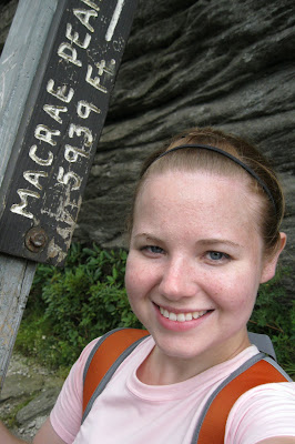
And so I climbed again and reached over the rock and set my feet across rock and to the next ladder, and the next, and the rock crops beyond until I made it to the final ladder to Macrae Peak. And then I climbed that and was at the top, not alone (people, couples, were laying down), but by myself enclosed but completely open in clouds.

I again crawled out to the edge, this time over 700 feet higher than before, and sat in the white. I ate some of my fudge (I've eaten fudge at 5,939 feet!) and called Jedsen. I called Jedsen and told him I was calling from a cloud, with four bars (rightly so), and then took several feet down and dropped the call.

See the person on the behemoth rock? That's Macrae Peak, and I sat for ten to fifteen minutes on the edge to his right. That was my peak--my first peak.


And then I descended, following the blue lines and arrows that had led me up. I followed the ladders back down, the ladders that gave me doubt, and because I had used them, ridden my fear of them by passing them, I stopped and took photos on the way down. The following photos are of the vertical, exposed area of doubt, and the ladders that led to and from the spot. You are looking down, then, up, then out.

And then I was back to the trail head after a three hour round-trip, solo hike to a peak. It was only .9 miles but was largely vertical, and there were 1.5 miles to go to the second peak and the end of the trail--but I couldn't have made it back in time. And one peak was a good start for a beginning but all-too-eager hiker. I didn't want to be stupid in my excitement.

So I went back to the bridge to say goodbye. You can see my shadow on the slopes.

I took a different way home, hoping for more mountains. I had heard of the Blue Ridge Parkway but hadn't been on it, so I sought out the sign for the Parkway to Asheville and decided to take it home. I learned while driving on the driving road (not a highway) that it was built along the crest of the Blue Ridge Mountains, and so I drove, over two hours (way longer than I had anticipated or planned for) past countless overlooks and through borderless clouds to Asheville. It was one of the most beautiful drives I have ever taken, and the photos below can't capture it. Want to know the best thing? One entrance to the Parkway is only an hour away.


No comments:
Post a Comment